

Hurricane Isaias Slams Florida Panhandle: Category 2 Landfall Near Destin Leaves Hundreds of Thousands in the Dark
Hurricane Isaias roared ashore near Destin, Florida, on Friday night as a powerful Category 2 storm, ripping part of a hotel roof off in Pensacola, triggering a flash flood emergency along the Emerald Coast and knocking out power to hundreds of thousands of homes and businesses across Florida, Alabama and Georgia. Just hours earlier, the first hurricane of the 2026 Atlantic season had been a major Category 3 storm churning across the Gulf.
- Landfall: near Destin, Florida, at about 8:30 p.m. CDT on Friday, October 9, as a Category 2 hurricane with winds near 110 mph.
- Power outages: more than 500,000 customers dark by late Friday, climbing toward 900,000 by Saturday morning.
- Damage: a Pensacola hotel lost part of its roof; downed trees and shattered streetlights blocked downtown streets.
- Flooding: a Flash Flood Emergency hit Destin and Fort Walton Beach as rain fell at up to 4.5 inches per hour.
- What's next: Isaias is pushing inland across Alabama and the Southeast with flooding rain and a tornado threat.


.jpg)

Hurricane Isaias Landfall: What Happened Friday Night
Hurricane Isaias came ashore near Destin around 8:30 p.m. CDT on Friday, October 9, 2026. The storm had strengthened into a Category 3 major hurricane on Friday morning, then eased slightly to about 110 mph — Category 2 strength — as its core reached the coast near Fort Walton Beach.
Forecasters warned the small drop in wind speed meant little. Isaias carried enormous energy from the Gulf, and the National Weather Service issued an extreme wind warning for Pensacola, telling residents to shelter as if a tornado were coming.
A record-breaking first hurricane
Isaias is the first hurricane of the 2026 Atlantic season — the latest "first hurricane" in 121 years — and the first hurricane to strike the U.S. since Milton two years ago. Before it, only tropical storms Arthur, Bertha and Edouard had reached the Gulf Coast this year.
"…when that water starts rising, that can be very, very dangerous."
Pensacola Damage: Roof Torn Off, Streets Blocked
Pensacola sat on the dangerous eastern side of the storm's approach. Video showed large sections of a hotel roof peeling away in seconds; CNN identified it as the Rest and Relax Inn on Plantation Road, near Interstate 10. Downtown, reporters found fallen trees, broken streetlights, glass and debris on nearly every block.
A wind gust of 102 mph was recorded at Pensacola City Hall, and Pensacola International Airport logged an 86 mph gust. Even so, some residents felt relieved. One Pensacola homeowner told the Associated Press that, for his area, "we really got fortunate."
Bridges closed, 911 limited
Bridges to the barrier islands close once sustained winds hit 39 mph. On Friday, the Three Mile Bridge, Garcon Point Bridge, Theo Baars Bridge and Bob Sikes Bridge were all shut. In Bay County, crews answered only life-threatening calls, and Lynn Haven halted emergency operations entirely during the worst of the storm.
Hurricane Isaias Power Outages Near 900,000
Outages rose fast. More than 343,000 customers were already dark before landfall. By 11:15 p.m. EDT Friday, the count passed 500,000 — about 370,000 in Florida and 210,000 in southern Alabama, with Georgia climbing. By early Saturday, CNN reported nearly 900,000 utility customers without power as Isaias moved inland.
| Measurement | Reading |
|---|---|
| Winds just before landfall | ~110 mph (Cat 2) |
| Gust, Pensacola City Hall | 102 mph |
| Gust, near Jay, Florida | ~118 mph |
| Peak rain rate, Okaloosa County | ~4.5 in/hour |
| Rain so far, Fort Walton Beach area | 6+ inches |
| Highest Gulf buoy wave | 27.6 feet |
Flash Flood Emergency in Destin and Fort Walton Beach
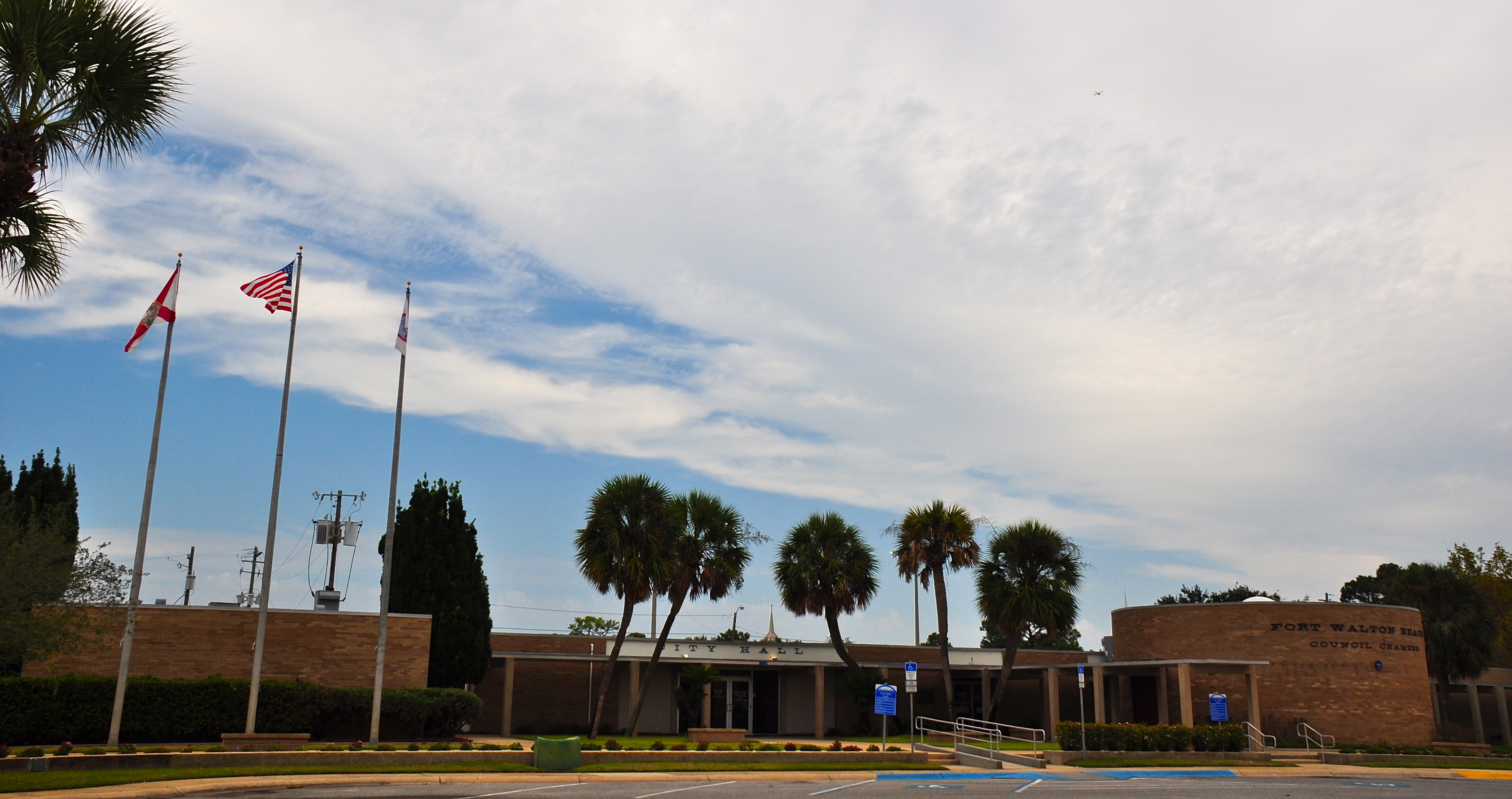
The heaviest rain fell right where the eye came ashore. A rare Flash Flood Emergency covered southern and coastal Okaloosa County, including Destin and Fort Walton Beach, as rain fell at 2 to 4 inches per hour. More than 6 inches had already soaked Fort Walton Beach, Destin and Niceville, and storm surge topped 5 feet in Panama City.
Forecasters expect 8 to 12 inches of rain near and east of the track, with isolated totals that could reach 25 inches.
Timeline: Isaias From Gulf Storm to Landfall
How Florida Prepared for Hurricane Isaias
Florida staged one of its biggest pre-storm responses in years:
- About 5,000 National Guard members mobilized, plus 175 Florida State Guard soldiers with aircraft, boats and amphibious rescue teams.
- An 88-member Miami-Dade urban search-and-rescue team moved to Tallahassee.
- 3 million meals, 1.1 million bottles of water and 16,000 linemen were ready to go.
- More than 100 ambulances were mobilized for patient transport and evacuations.
- Uber offered free rides (up to $40 each way) to state-approved shelters with the code ISAIAS26.
Evacuating residents made hard choices. As one Pensacola Beach resident put it while heading out, "Remember, the house is just a thing."
Where Is Hurricane Isaias Going Next?
Isaias is racing inland over Alabama and the Southeast this weekend. Forecasters warn its winds will reach far inland, unlike storms that fade quickly near the coast. Flash flood warnings are spreading into Alabama, and the tornado threat is highest over the central Florida Panhandle and southern Georgia, with parts of the Carolinas at risk by Sunday.
After landfall, Isaias weakened to a Category 1 hurricane. ABC News tracking put it about 45 miles east-northeast of Pensacola with 90 mph winds, moving north at 20 mph. Its forecast track takes it across Alabama and Georgia, weakening to about 60 mph by 7 a.m. CT Saturday and 35 mph by 7 p.m. CT Saturday.
Early next week, Isaias is expected to turn east across the Appalachians and move off the mid-Atlantic coast.
Gulf oil output disrupted
Energy companies shut in about 1.3 million barrels of daily Gulf oil production by Thursday to protect workers. Forecasters expected the strongest winds to pass south and east of most offshore rigs, though refineries in Alabama could still face disruption.
- Run generators outside, away from windows and doors — carbon monoxide kills.
- Stay off the roads so crews can clear trees and restore power.
- Never drive through flooded streets.
- Florida's emergency hotline: 1-800-342-3557.
Hurricane Isaias FAQ
Where did Hurricane Isaias make landfall?
Near Destin, Florida, in the western Florida Panhandle, at about 8:30 p.m. CDT on Friday, October 9, 2026, as a Category 2 hurricane.
How strong was Hurricane Isaias at landfall?
About 110 mph sustained winds — Category 2. It had been a Category 3 major hurricane earlier on Friday.
How many people lost power?
More than 500,000 customers in Florida, Alabama and Georgia by late Friday, rising to nearly 900,000 by early Saturday.
Where is Hurricane Isaias going next?
Inland across Alabama and the Southeast this weekend, then east over the Appalachians and off the mid-Atlantic coast early next week.
Is Isaias the first hurricane of 2026?
Yes — it is the first hurricane of the 2026 Atlantic season and the first to make U.S. landfall this year.
Hurricane Isaias weakened slightly before landfall, but it still hit the Florida Panhandle with 100+ mph gusts, flash flooding and outages for close to a million customers. The danger isn't over: flooding rain and tornadoes are moving inland across the Southeast this weekend. If you're in its path, follow local officials and stay off the roads.
This article is based on a report from MSN (إم إس إن).
Read the original report ↗Additional sources: AccuWeather · CNN · CBS12 · WEAR-TV

